宇達光學股份有限公司 Unidar Technologies, Inc.

全方位自製光達與光學感測矩陣 Comprehensive In-House LiDAR & Optical Sensing Matrix

我們的產品系列 Our Product Lines

下載產品型錄與解決方案簡報 Download Product Portfolio & Solutions

📄 下載產品型錄 (繁體中文 PDF)

Laser Measurement 雷射測距儀與高度計

Drone Altimeter

無人機高度計 (Drone Altimeter)

Drone Altimeter

採 905nm 超小型、低功耗雷射測高模組,重量 < 25g、功耗 < 1W。提供即時高速高度回授,專為多旋翼及工業無人機 OEM 模組化設計,支援起降輔助、低空定高與地形跟隨飛行。
A 905nm ultra-compact (<25g) and low-power (<1W) laser altimeter module. Provides real-time high-speed altitude feedback for multirotor and industrial drones, supporting terrain following, altitude hold, and autonomous precision landing.

  • ✓ 極致輕量化 < 25g,極低功耗 < 1W
  • ✓ Ultra-lightweight < 25g and low power consumption < 1W
  • ✓ 0.1 ~ 120m 探測範圍與 ±3cm 測量精度
  • ✓ 0.1 – 120m measurement range with ±3cm high accuracy
  • ✓ > 10kHz 高速資料率,提供即時高度回授
  • ✓ > 10kHz data rate for instantaneous altitude feedback
  • ✓ 適用自動起降、地形跟隨、下方避障與無 GPS 環境作業
  • ✓ Ideal for auto landing, terrain tracking, obstacle avoidance, and GNSS-denied ops
10km Long-range Laser Rangefinder

10km 長程雷射測距儀 (10km Laser Rangefinder)

10km Long-Range Laser Rangefinder

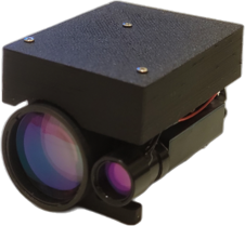
採用 1.5µm 人眼安全雷射,具備 30 至 10,000 公尺遠距探測能力。重量僅 < 120g、功耗 < 2W,專為三光光電球整合、長距離目標監偵、定位量測、前進觀測與地面反無人機監視系統設計。

Employs a 1.5µm eye-safe laser with extreme distance detection from 30m up to 10,000m. Ultra-lightweight (<120g) and low power (<2W), optimized for EO/IR gimbals, long-range surveillance, target localization, forward observation, and C-UAV monitoring.

  • ✓ 30 ~ 10,000m 極遠量測距離(1.5µm 人眼安全波長)
  • ✓ 30 to 10,000m long range (1.5µm eye-safe wavelength)
  • ✓ 高精度:±5cm (≤100m) / ±0.05% (>100m)
  • ✓ High precision: ±5cm (≤100m) / ±0.05% (>100m)
  • ✓ 重量 < 120g,功耗 < 2W,體積精巧 < 45×41.6×59.9 mm
  • ✓ Weight < 120g, power < 2W, compact form factor < 45×41.6×59.9 mm
  • ✓ 適合光電球整合、目標定位量測與地面反無人機監視
  • ✓ Designed for EO pod integration, target positioning, and counter-UAS surveillance

Laser Measurement 技術規格

規格項目 Specification 無人機高度計 Drone Altimeter 10km 長程雷射測距儀 10km Laser Rangefinder
雷射波長 Laser Wavelength 905 nm 1.5 µm
量測範圍 Measurement Range 0.1 ~ 120 m 30 ~ 10,000 m
量測精度 Accuracy ±3 cm ±5 cm (≤100m) / ±0.05% (>100m)
資料率 / 重複率 Data Rate / PRF > 10 kHz 1 ~ 10 Hz
外觀尺寸 Dimensions < 43 × 35 × 46 mm < 45 × 41.6 × 59.9 mm
模組重量 Weight < 25 g < 120 g
模組功耗 Power Consumption < 1 W < 2 W
通訊介面 Interface RS232 RS232 / RS422
市場定位與任務 Target Mission 無人機起降、定高、貼地飛行 Takeoff/landing, terrain following, altitude hold 監偵、定位、前進觀測、三光光電球 Surveillance, positioning, EO pod integration

LiDAR Systems 光達感知系統

Drone LiDAR

無人機光達 (Drone LiDAR)

Drone LiDAR (1D Scan)

自製 1D 掃描式高度與距離感知模組,具備 ≥ 90° 視場角與 0.1° 高角解析度,掃描更新率達 ≥ 50kHz。專為海事巡檢、基礎設施巡查、海上/山區搜救與災後評估之大型任務型 UAV 載荷設計。
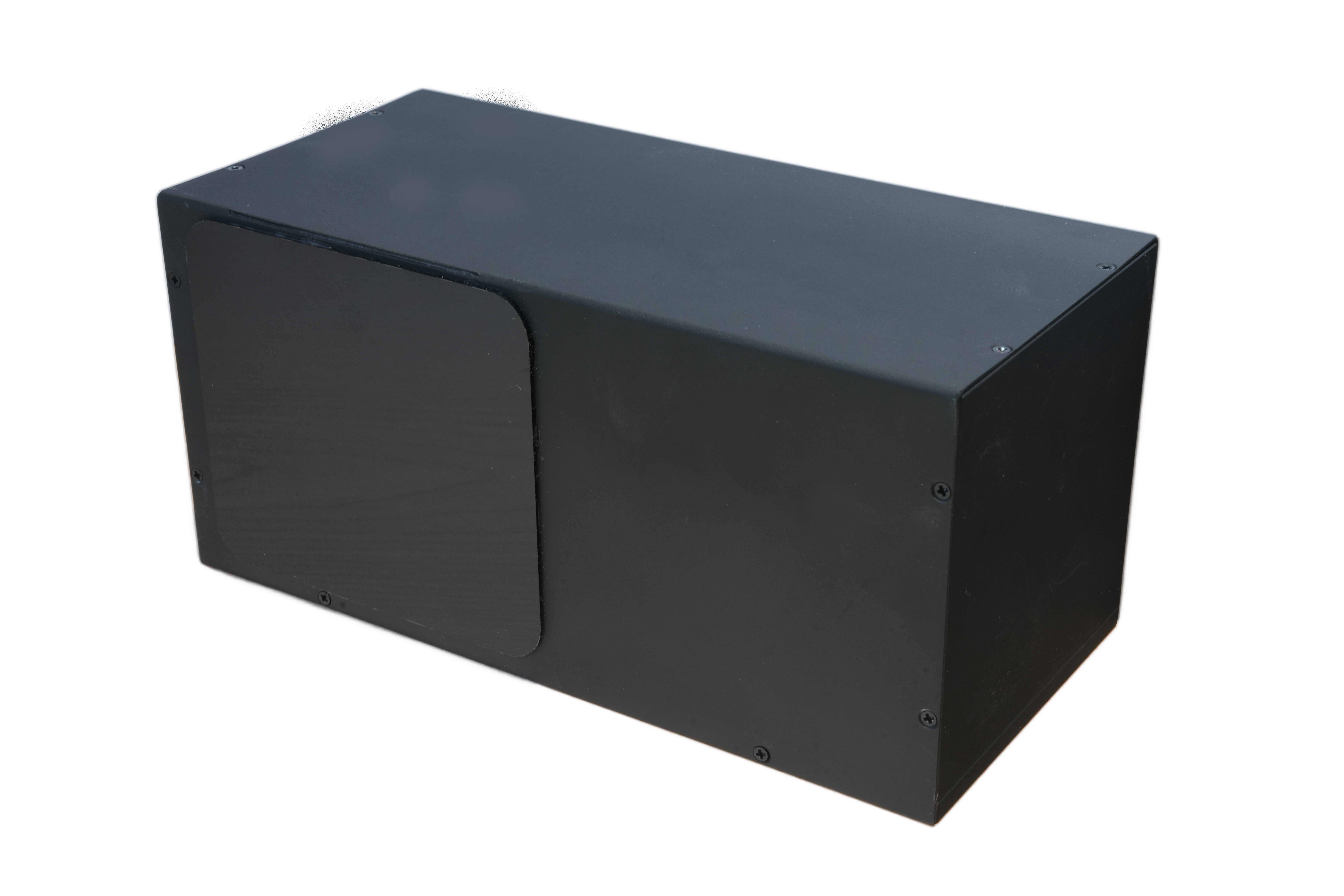
An in-house 1D scanning LiDAR module with ≥90° FoV and 0.1° angular resolution, operating at ≥50kHz high scan rates. Designed for mission UAV payloads in maritime surveillance, infrastructure inspections, mountain/sea SAR, and disaster assessment.

  • ✓ 1D 動態掃描型式,視場角 FoV ≥ 90°,角解析度 0.1°
  • ✓ 1D scanning pattern with ≥ 90° FoV and 0.1° angular resolution
  • ✓ 0.1 ~ 120m 量測範圍,±3cm 測量精度
  • ✓ 0.1 – 120m detection range with ±3cm precision
  • ✓ ≥ 50kHz 高資料率,重量 < 300g
  • ✓ ≥ 50kHz high data rate with ultra-light weight < 300g
  • ✓ 採用 100 MHz Base-T1 車載/航太級高可靠通訊介面
  • ✓ 100 MHz Base-T1 high-reliability communication interface
  • ✓ 支援海岸巡防、港口巡檢、橋梁/輸電線/風能設施巡檢與搜救災調
  • ✓ Applications: Coastal patrol, harbor inspection, powerline/wind farm checks, SAR
2U 25km CubeSAT LiDAR

2U 25km 立方衛星光達 (CubeSAT LiDAR)

2U 25km CubeSAT LiDAR

採用 532nm / 1064nm 雙波長設計之 2U 標準太空測距測高光達。專為小型衛星與 CubeSat 平台打造,具備 ≥ 25km 極長測距與 ≤ 50mm 精密測高能力,支援衛星交會接近 (RPO)、在軌目標測距與太空碎片監測。

A 2U standard spaceborne LiDAR featuring 532nm/1064nm dual wavelengths. Tailored for CubeSats and small satellites, it achieves ≥25km long-range measurement and ≤50mm altimetry precision for rendezvous/proximity operations, on-orbit tracking, and space debris monitoring.

  • ✓ 532nm / 1064nm 雙波長設計,提升穿透力與目標辨識效能
  • ✓ 532/1064nm dual wavelength for superior penetration and target identification
  • ✓ 長距離測距 ≥ 25km,高精度測高 ≤ 50mm (1σ)
  • ✓ Long-range tracking ≥ 25km with precision altimetry ≤ 50mm (1σ)
  • ✓ 10°(H) × 10°(V) 視場角,0.05° 角解析度,資料率 ≥ 1kHz
  • ✓ 10°×10° FoV with 0.05° angular resolution and ≥1kHz high data rate
  • ✓ 標準 2U 機構設計 (< 95×95×200 mm),重量 < 1500g,功耗 < 30W
  • ✓ Standard 2U form factor (< 95×95×200 mm), weight < 1500g, power < 30W
  • ✓ Ethernet 介面,便於與星載電腦 (OBC) 及地面任務系統無縫整合
  • ✓ Ethernet interface for seamless onboard computer (OBC) and ground station integration
2U Underwater LiDAR

2U 水下光達 (Underwater LiDAR)

2U Underwater LiDAR

採用 532nm 綠光與 1064nm 近紅外雙波長設計。1064nm 雷射鎖定水面基準定位,532nm 綠光高效穿透水體量測海床,量測深度可達 50 公尺,精度達 ≤ 50mm。適用於淺海測繪、港口航道測深、水下障礙物辨識與海洋生態監測。

Features 532nm green and 1064nm NIR dual wavelengths. 1064nm provides sea surface referencing while 532nm green laser penetrates water bodies down to 50m with ≤50mm precision. Ideal for shallow water bathymetry, port/channel charting, obstacle mapping, and coastal ecology tracking.

  • ✓ 532/1064nm 雙波長光學架構,水下探測深度 ≤ 50m
  • ✓ 532/1064nm dual-wavelength architecture with underwater penetration ≤ 50m
  • ✓ 測深精確度 ≤ 50mm (1σ),資料率 ≥ 1kHz
  • ✓ Bathymetric accuracy ≤ 50mm (1σ) with ≥ 1kHz high-speed sampling
  • ✓ 視場角 10°(H) × 10°(V),角解析度達 0.05°
  • ✓ 10°×10° Field of View with 0.05° fine angular resolution
  • ✓ 2U 標準機架封裝 (< 95×95×200 mm),重量 < 1500g,功耗 < 30W
  • ✓ Compact 2U standard enclosure (< 95×95×200 mm), < 1500g, power < 30W
  • ✓ 適用淺海地形測繪、港口航道測深、河川湖泊水深調查、水下搜救與障礙辨識
  • ✓ Applications: Shallow seabed mapping, harbor navigation charting, river/lake depth, underwater SAR

LiDAR Systems 技術規格

規格項目 Specification 無人機光達 (1D Scan) Drone LiDAR 立方衛星光達 (CubeSAT) CubeSAT LiDAR 水下光達 (Underwater) Underwater LiDAR
雷射波長 Laser Wavelength 905 nm 532 / 1064 nm 532 / 1064 nm
量測範圍 / 深度 Measurement Range 0.1 ~ 120 m ≥ 25 km ≤ 50 m (水下深度)
量測精度 Accuracy ±3 cm ≤ 50 mm (1σ) ≤ 50 mm (1σ)
資料更新率 Data Rate ≥ 50 kHz ≥ 1 kHz ≥ 1 kHz
視場角 (FoV) Field of View ≥ 90° (1D Scan) 10°(H) × 10°(V) 10°(H) × 10°(V)
角解析度 Angular Resolution 0.1° 0.05°(H) × 0.05°(V) 0.05°(H) × 0.05°(V)
外觀尺寸 Dimensions 140 × 73.7 × 74 mm < 95 × 95 × 200 mm (2U) < 95 × 95 × 200 mm (2U)
模組重量 Weight < 300 g < 1500 g < 1500 g
模組功耗 Power Consumption < 5 W < 30 W < 30 W
傳輸介面 Interface 100 MHz Base-T1 Ethernet Ethernet
主要市場與任務 Target Applications 海事巡檢、基礎設施巡查、搜救災調 Maritime patrol, infrastructure inspection, SAR 交會接近、測高、在軌目標測距 Rendezvous/docking, altimetry, debris monitoring 淺海測深、港口航道、水文海洋監測 Bathymetry, seabed mapping, marine ecology

* 宇達光學自製自主核心技術・產品規格與性能會持續優化,規格變更以官方最新出廠文件為準。 * In-house proprietary optical sensing technologies. Specifications are subject to ongoing improvements without prior notice.

關於我們 About Us

成立時間

Founded

2025 年 9 月 19 日

September 19, 2025

員工顧問人數

Employees & Advisors

12 People

宇達光學 (Unidar Technologies) 致力於拓展嚴苛環境下的感知能力極限。我們專注於研發先進的光達 (LiDAR)、雷射測距儀 (rangefinders) 及高度計 (altimeters),為複雜的需求打造創新的解決方案。我們的方案能顯著提升安全性與態勢感知能力 (operational awareness),為全球的商業、工業及國防安防應用帶來助益。

我們堅持內部垂直整合,提供由近距定高、任務掃描、萬米監偵、太空測距至水下測深的完整感知矩陣。創新、品質、誠信、當責是我們一切行動的核心準則。

Unidar Technologies expands the potential of perception for critical environments. We engineer advanced LiDAR, rangefinders, and altimeters, creating innovative tools for complex needs. Our solutions dramatically improve safety and operational awareness, benefiting commercial, industrial, and defense applications globally.

We provide total cohesive solutions with 100% in-house vertical integration, establishing a complete sensing matrix spanning drone altimeters, task LiDARs, long-range rangefinders, space CubeSATs, and underwater bathymetry.

核心價值觀 Core Values

技術創新 Innovation
誠信篤實 Integrity
追求卓越 Quality
主動擔責 Accountability & Proactive

我們的團隊 Our Team

高坤勇 Alex Kao

董事長 Chairman

憑藉超過 20 年的專業投資經驗,曾任職於多家上市櫃及私人企業的董事會。

林志平博士 Dr. Chih-Ping Lin

執行長 CEO

擁有應用電子博士學位,在其豐富的職業生涯中(包含擔任國家級研究機構科學家)即為享譽業界的光達 (LiDAR) 專家。

陳博士 Dr. Fred Chen

軟體與 DevOps 架構長 Chief Architect of Software and DevOps

擁有工學博士學位,專業領域涵蓋系統整合、軟體架構與驗證、電信、網路技術以及資訊安全系統。

吳博士 Dr. Hogan Wu

雷射總工程師 Chief Laser Engineer

擁有光電科技博士學位,為宇達光學帶來了其在雷射光學及超快雷射系統領域的深厚專業知識。

公告 Notice

全企業級資訊安全

在宇達光學,資訊安全是我們深植內心的全公司核心經營理念。我們維護數據完整性的承諾遍及所有產品組合,涵蓋了嵌入式系統、應用軟體,以及專有的 3D LiDAR 點雲處理技術架構。

2026 年 1 月 6 日發布資安政策後,我們於 3 月 11 日成功通過 AFNOR 稽核,並於 2026 年 4 月 1 日正式取得 ISO 27001 認證。這證實了我們所有業務單位的安全控制措施均符合最高國際標準。

透明度與合規性:

Corporate-Wide Information Security

At Unidar Technologies, Inc., information security is a foundational corporate-wide mindset. Our commitment to data integrity encompasses our embedded systems, application software, and proprietary 3D LiDAR point-cloud processing stacks.

Following our policy launch on January 6, 2026, we successfully passed our AFNOR audit on March 11 and officially received our ISO 27001 certification on April 1, 2026. This validates that our security controls across all business units meet the highest international standards.

Transparency & Compliance:

聯絡我們 Contact Us

🏢

公司名稱 Company

宇達光學股份有限公司

Unidar Technologies, Inc.

☎️

連絡電話 Telephone

+886-3-6681836

+886-3-6681836

📍

地址 Address

新竹縣竹北市文興路一段 158 號 3 樓

3F, 158, Section 1, Wenxing Rd, Zhubei City, Hsinchu County, 302054

✉️

Email

sales@unidartech.com